
Start with a two-sided heritage landscape
Matera’s famous view can shrink the place into a bowl of stone houses. The World Heritage property is larger and more useful to understand: UNESCO defines it as the ancient districts of Matera together with the Park of the Rupestrian Churches on the Murgia plateau. Across 1,016 hectares, houses, churches, monasteries and hermitages are set into a landscape of caves, ravines and high ground. For someone considering life here, the ravine is not scenery between attractions. It separates two sides of one cultural landscape, so the Sassi, the plateau opposite and the relationship between them deserve to be read together.
- The World Heritage property includes the Sassi and the park
- The plateau opposite is part of the cultural landscape
Learn the city’s vertical grammar
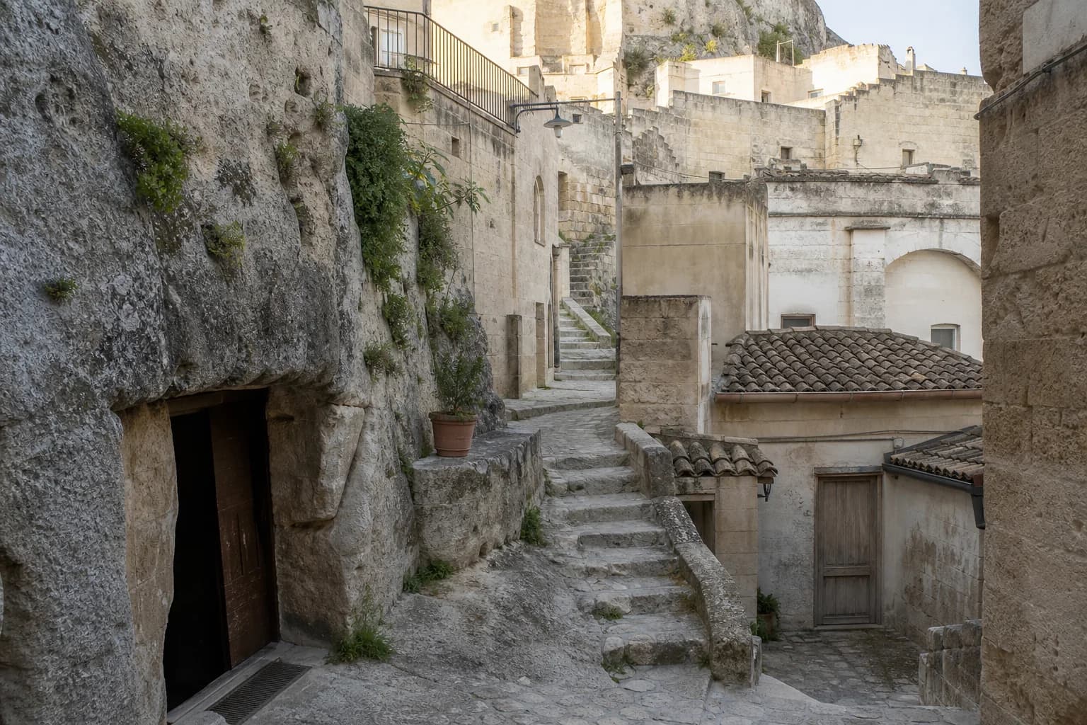
The old city has a legible structure once you stop treating every stone lane as interchangeable. Sasso Caveoso and Sasso Barisano occupy two folds in the terrain, with the Civita—the early fortified nucleus and cathedral site—between them. UNESCO’s description also distinguishes Casalnuovo and the later Piano in the historic centre. The Ministry of Culture’s Casa Cava study adds another layer: rooms may be fully or partly cut from rock, while streets, churches, underground spaces and water channels form a single urban fabric. Those names are practical orientation, not decorative vocabulary; they help you compare routes, slopes and addresses with more precision.
- Caveoso and Barisano are divided by the Civita
- Rock-cut rooms and built structures form one urban fabric
See a neighborhood, not a cave display
Calling the Sassi “caves” misses both their scale and their construction. UNESCO records more than a thousand dwellings, alongside shops and workshops, within the property. Its account of early houses describes natural cavities closed with walls made from excavated blocks: cutting and building worked together. That distinction matters when looking at a home, studio or public space today. A rock-cut room is not evidence that every part of the address is prehistoric, and a masonry frontage does not make it separate from the rupestrian system. Read each place as a layered structure rather than a single-age artifact.
- The property contains more than a thousand dwellings
- Excavated and constructed elements belong to the same system
Cross the ravine to complete the story
The park’s rock churches extend that layered history beyond the urban lanes. The park authority counts about 150 places of worship, ranging from the early Middle Ages to the nineteenth century. It also cautions against reducing them to a purely monastic or Byzantine phenomenon: the group includes monasteries, shrines, former parishes and institutions connected to bishops, while many sites served people dispersed across a wide rural territory. That makes the plateau more than a viewpoint over the Sassi. It is evidence of how worship, settlement and movement were organized across the landscape, and it belongs in a resident’s mental map of Matera.
- About 150 rock-cut worship sites span many centuries
- The churches served a complex rural and institutional landscape
Hold displacement and return together
Matera’s heritage story includes a severe break. UNESCO says the population of the Sassi was relocated in the 1950s as authorities sought to improve sanitation and renovate the districts. Abandonment brought degradation; people began returning from the 1980s, restoring residential use and life to the property. This is more honest than either of the easy stories—that the Sassi survived unchanged, or that recovery simply converted ruins into an attraction. A prospective resident should hold displacement and return together. The visible fabric carries both long occupation and a modern, planned interruption whose consequences extend well beyond the old quarters.
- The 1950s relocation interrupted occupation of the Sassi
- Residential return began from the 1980s
Follow the history into modern Matera
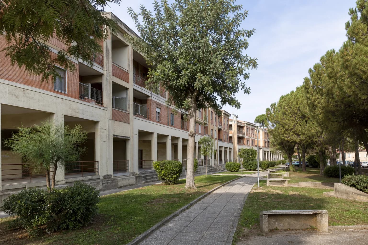
One place to follow the postwar city is Spine Bianche. The Ministry of Culture’s architecture census identifies it as a Risanamento Sassi neighborhood, planned from the mid-1950s for 687 dwellings between the centre and the city’s new expansion. Its design translated the idea of the vicinato, or neighborhood cluster, into an urban plan with modern services, green areas and roads. You do not need to prefer postwar Matera to learn from it. The official classification connects this modern district to the same historical chapter as the old quarters and shows how planners tried to carry social patterns into a different built form.
- Spine Bianche belongs to the Risanamento Sassi program
- Its plan reinterpreted the vicinato with modern services
Treat stewardship as part of the address
Heritage status also shapes practical decisions. UNESCO says activities or interventions affecting the property require prior approval from the relevant heritage offices, while Law 771/1986 placed recovery planning and management with the municipality. Matera still maintains a Sassi service responsible for planning and management under that law, with links to rules on furnishings, cultural assets, leases and recovery plans. This is context, not property-specific legal advice. Before treating an unusual interior, facade or public-space detail as freely changeable, identify whether an address falls within protected territory and ask the competent municipal and heritage offices what applies. In the Sassi, stewardship is part of the address.
- Protected-property interventions sit within a formal approval system
- The municipal Sassi service manages planning under Law 771/1986
Sources and further reading
- The Sassi and the Park of the Rupestrian Churches of Matera — UNESCO World Heritage Centre
- I Sassi e il parco delle Chiese rupestri di Matera — Italian Ministry of Culture UNESCO Office
- Casa Cava — Italian Ministry of Culture Contemporary Architecture Atlas
- Le Chiese Rupestri — Parco della Murgia Materana
- Sassi Service — Comune di Matera
- Quartiere Spine Bianche — Census of Italian Architecture since 1945